Satellite Cameras and New Ways of Environmental Protection
Space technology has long become a part of our daily lives, contributing its share to communication, navigation, finances, and many other activities we take for granted. Recently, satellite images taken from space have acquired another important part — they’ve started to provide valuable data on climate change and environmental protection, helping us track and, as much as we can, preserve the resources we have at hand.
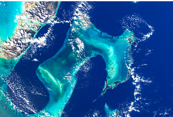
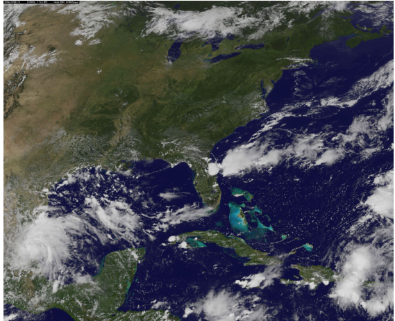
Advanced satellite camera technology has made it possible to receive up-to-date information on wild and marine life, changing forest covers, and of course, greenhouse gas pollution levels. All of this information is used for the better of our planet. But what is environmental protection and management and how does a satellite camera work to ensure natural resource preservation? Let’s take a closer look.
Satellite Camera Use as Revolution in Environmental Protection
There are two main benefits of satellite camera imagery for environmental protection. First, modern satellites use highly advanced optics that captures images in unprecedented detail, giving us a very accurate picture of our planet’s environment. Second, the images become available to large audiences, increasing awareness of the state of our planet’s resources and the need for environmental protection.
But how do define environmental protection? Which resources are dwindling because naturally and which diminish as the result of human activity? Satellite imagery gives us insight on this as well, capturing the same areas over time and providing scientists with accurate data on what is going on the in the most remote corners of our planet. Remote sensing shows us how natural habitats, flora, and fauna, change over time and urge people to take countermeasures that ensure environmental protection. Now, let’s take a look at some practical examples of how satellites help with environmental protection.
Satellite Camera Use for Wildlife Conservation & Environmental Protection
The concept of using satellite imagery for analyzing wildlife is not new. Back in the 1990s, researchers used GPS transmitters to observe the penguin population. As a result, they found out that penguins died en masse after crossing oil-polluted waters in the Atlantic. As the result of this monitoring, ship routes were changed to reduce the pollution and, today, Magellanic penguins are no longer endangered species. This major environmental protection milestone has been made possible thanks to satellite imagery and timely reaction to a hazardous situation.
However, preserving the Magellanic penguin population is not the only example of wildlife environmental protection. In 2014, environmentalists have turned their attention to polar bears, using satellites to count the bear population in the Canadian Arctic. Now, should any noticeable decrease take place, satellite images will be analyzed once again in search of valid environmental protection initiatives?
Keeping an Eye on Tropical Rainforests for Environmental Protection
Animals are not the only ones in need of environmental protection. Tropical rainforests in Amazon are also dwindling, which endangers entire ecosystems. More importantly, deforestation increases the levels of CO2 emissions into the atmosphere, which eventually contributes its share to global warming and further environmental hazards for everyone back on Earth.
Scientists today are certain that preserving tropical rainforests is one of the primary environmental protection initiatives because it can help slow down the global warming process. Before 2013 when the researchers published their report on environmental hazards, 27,000+ square km of rainforest could be cut down in a single year. Now, the authorities have managed to reduce this number dramatically, clearing out no more than 5,000 square km a year.
Monitoring Ocean Ecosystem Changes for Environmental Protection

Oceans cover over 70% of our planet’s surface, which makes them an important part of our ecosystem. Similar to forests, oceans capture CO2 emissions, reducing the accumulation of harmful greenhouse gases in our planet’s atmosphere. Still, there is a catch. When oceans capture excessive amounts of CO2, the water acidifies, which generally has a destructive effect on the marine ecosystem. Acid water is particularly harmful to oysters and corals that now need some serious environmental protection. In the last 30 years, over half of all coral reefs worldwide have already been destroyed, which left roughly 25% of marine animal species homeless. If the tendency goes on as is, we will lose 90% of our coral reefs in the next 50 years or less.
Right now, it is not entirely clear how environmental protection advocates can save the corals, but satellite cameras keep a watchful eye on companies that dump waste, oil, and plastic, into ocean waters. Without satellite technology, we would never find out just how much plastic waste is dumped into oceans annually and it would be impossible to find parties responsible for the disposal of oil.
Of course, to ensure proper environmental protection, satellite cameras alone will not be enough. Governments and the public worldwide will have to propose actionable steps to combat the consequences of industrial activity. But the good news is that satellite imagery gives us factual data to argue our environmental protection goals.


